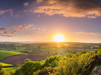
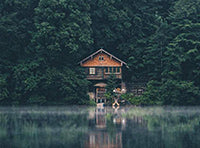
A wild and rugged landscape of deep valleys, high fells, mountain passes and crystal-clear tarns, Lakeland has inspired countless writers, poets and artists.
Being England’s largest national park, it is not surprising that everything in the Lake District is on a grand scale. Home to imposing mountains, ten of its peaks are over 3,000ft. The most famous include Scafell Pike – England’s highest mountain – as well as neighbouring Scafell and the similarly renowned Helvellyn.
Visitors to Lakeland will discover deep glacier-cut valleys, towering fells and wild mountain passes. Amongst the high fells, there are isolated tarns to be discovered, hundreds of metres above sea level, offering an unmissable opportunity to swim in crystal clear water amongst a rugged and beautiful backdrop.
Geography
There have been many attempts at separating or classifying the Lake District into different zones or geographical areas in order to help visitors navigate around the region. Some guides choose the lakes themselves, the larger towns, the parish boundaries or simply draw arbitrary lines to separate the points of the compass, such as the north lakes, east lakes and so on.
However, as a lifelong explorer of Lakeland, walker and guidebook author Alfred Wainwright came up with one of the most practical means of creating internal borders within the Lake District. He used natural boundaries such as lakes, valleys and passes to separate the region into seven distinct groups of fells, each the subject of a book.
The Eastern Fells – containing Helvellyn. The Eastern Fells are boxed in by the A66 to the north, Ullswater and A592 to the east, Thirlmere and the A591 west and Ambleside to the south.
The Far Eastern Fells – containing High Street, Haweswater and Kentmere Common. Windermere marks the southeastern border with the Southern Fells, while the A592 or Kirkstone Pass marks the western border with the Eastern Fells. Meanwhile, Shap and the A6 mark its eastern boundary and the outer edge of the Lake District.
The Central Fells – containing High Raise, Castlerigg and Keswick.These fells mark the northern boundary, with Derwentwater and Borrowdale to the east, and Thirlmere and the A591 to the west.
The Southern Fells – containing Coniston in the south and Scafell in the east. The Sty Head Pass marks the northeast border with the Western Fells, while Langdale separates them from the Central Fells further north.
The Northern Fells – containing Skidaw, Knott, Whitewater Dash and Overwater Tarn. Bassenthwaite Lake and the River Derwent separate this group from the Northwestern Fells to the southeast. The B5229 is its northernmost boundary.
The Northwestern Fells – containing Grasmoor, Moss Force Waterfall and Dale Head. A chain of lakes – Loweswater, Crummock Water and Buttermere – along with the Honister Pass mark the southern boundary of this region.
The Western Fells – containing Pillar, Ennerdale, Scale Force Waterfall and Wasdale Head. Wastwater separates this from the Southern Fells and the Honister Pass to the north marks its boundary with the Northwestern Fells.
Geology
A visitor to the Lake District can’t help but notice that the geology here is very different from that of southern England. It has more in common with Scotland and Wales. During the last Ice Age, the Grampians, Northwest Highlands, Lake District and Snowdonia were all under vast ice sheets. Upland depressions filled with ice and snow. Eventually, like a cup left under a running tap, these depressions overflowed, and the ice seeped down the hillside in the form of glaciers. Fluctuating temperatures created continuous freeze-thaw conditions. Cracks and fissures in the rocks expanded, resulting in large chunks eventually breaking off and falling into the path of the slow-moving glaciers. Forcing their way down through small river-cut valleys, these already rock-laden frozen rivers of ice took on more rocks, stones and gravel. Acting like giant sheets of sandpaper, they carved out the large ‘U’ shaped basins we see today.
The Hardknott Pass
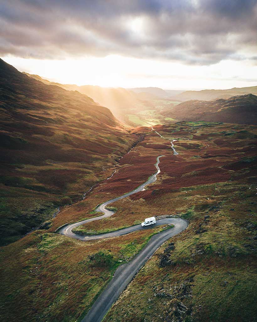
First laid down by the Romans in AD 110, the Hardknott Pass is a remote stretch of road full of hairpin bends and steep climbs. It connects the tourist hub of Ambleside to the Eskdale Valley and has been called ‘the wildest road in Britain’. From the Roman fort to Blea Tarn car park in Little Langdale, it has an altitude gain of close to 541m or 1,775ft and a maximum gradient of 33%. Every local in the area will have stories of burnt-out clutches and failed brakes as motorists come a cropper on this tough mountain pass. If you are brave, or crazy enough to drive this challenging road, it is best tackled in good weather and in a low gear. The road surface is not as well maintained as some European counterparts and you’ll be contending with potholes and crumbling road surfaces.
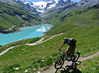
Whether fearless or simply masochistic, cyclists see the road as one of their greatest challenges, often training for months before taking to the tarmac. Not all succeed, as no matter which direction you tackle the pass, you’ll encounter two climbs of 2km or more and a 33% gradient. Those who brave it tend to favour the route from Ambleside to Eskdale, as it’s a little less punishing. The introduction of e-bikes has opened up the pass to a whole new breed of cyclist, but even these have been known to give up on this punishing climb.
Advice from local police is to avoid driving or cycling the route if you don’t have much experience. However, for well-seasoned drivers or cyclists, it can be one of the most thrilling sections of road in Europe.
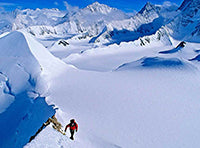
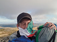
Climbing Scafell Pike
Few visitors to the Lake District consider the trip to be complete without tackling the 978m or 3,209ft massif of Scafell Pike. For beginners or weekend walkers, your best bet is to take the route up from Wasdale. A slow but steady ascent, it takes around 5 to 6 hours in total. It will take its toll on your calf muscles and you may find yourself stopping to ‘admire the view’ more times than you’d like to admit, but it will be less challenging than some of the other routes. You can head straight up or take the corridor route from Sty Head Tarn.
Another way up, also taking in the corridor route, is to head up from Seathwaite. This is around 15km as a round trip and can take anything from 5 to 7 hours. Often voted the best route up, it takes you on a steady, more gradual climb to the top.
Finally, there’s also the option to climb it from Eskdale. One of the most stunning routes to the summit, this path is not without its challenges. Undoubtedly a way up for experienced walkers only, you will pass through some of the region’s most remote and beautiful landscapes.
Stone Circles of the Lake District
The stone circles of the Lake District are often overlooked in favour of the more famous Neolithic and Bronze Age monuments of southern England, such as Stonehenge and Avebury. But this is doing these great prehistoric feats of engineering a disservice. The antiquarian and archaeologist Aubrey Burl described the stone circle at Swinside as “the loveliest of all the circles in Northwest Europe”, whilst English Heritage describe the great stone circle at Castlerigg as “perhaps the most atmospheric and dramatically sited of all British stone circles”. As such, the following sites are all well worth a visit.
Castlerigg – A 20-minute cycle ride from Keswick, positioned in a natural amphitheatre, Castlerigg is one of the most picturesque stone circles you’ll ever visit.
Blakely Rise stone circle – A small but perfectly formed stone circle, just off the road. Ideal for a quick stop off.
Sunkenkirk/Swinside – Situated in a far southwestern corner of the Lakes, around 2km down a remote lane, this is one of the least visited but best-preserved stone circles in the UK.
Cockpit stone circle – A short walk from Askham Village, on a high moorland plateau, Cockpit may not be a true stone circle but a ‘ring cairn’; a burial monument dating back to the Bronze Age.
When to go
No matter what time of year you visit the Lakes, you’ll need to bring wet weather gear with you! The Lake District has been described as Britain’s wettest region. Whilst Wales, parts of Scotland and Dartmoor might compete for this trophy, Cumbria does get more than its fair share of wet weather, right across the seasons. So, whilst there may be less rain during the summer months, there is still every chance of a sudden downpour.
In terms of an ideal time to visit, each season has its charms. If you don’t like crowds, the summer months should be avoided, especially late July and August during the school holidays. However, if you avoid the main tourist areas, you will be able to escape the worst of the crowds. May, June and September are great times to go if you want the best chance of good weather (but still note the advice given in the previous paragraph!). Snow tends to fall between December and March, so bring the right equipment should you choose to stay during the winter.
Where to stay
Such is the landscape of the Lake District that short distances of no more than 20 miles can take anything up to an hour by car. Needless to say, where you choose to stay can have a great impact on what you see and what you do. Before you book anything, check the times and distances between where and what you would like to do in relation to where you want to stay.
Youth Hostels
The Youth Hostel Association (YHA) has nineteen hostels in total within the Lake District. They range from those close to civilisation, such as the Keswick hostel close to town and Ambleside on the shores of Lake Windermere, to wild getaways such as the mountainside hostel at Helvellyn, situated 963ft up and 40 minutes’ walk from a ski slope.
Most YHA hostels have self-catering kitchens and shared lounges. Some sites offer breakfast, lunch and dinner and a bar for that well-earned evening pint. With private rooms, shared male and female dorms, camping pitches, cabins and even the opportunity to rent out the entire hostel to the largest groups, there are options for every accommodation preference and every budget.
In addition to YHA hostels, Stanley House is an ex-luxury hotel run as a self-catering hostel. You can rent a room for the night or hire the whole building out at once. Both are very affordable. Within easy reach of the Hardknott Pass, Wastwater and Scafell, it acts as a perfect, affordable basecamp for exploring the western Lake District.
Bothies
It is a common misconception that bothies only exist in Scotland. Whilst the Mountain Bothy Association (MBA) manages more bothies in Scotland than any other part of the country, you will also find them dotted throughout the uplands of Northern England and North Wales. Overnight stays in bothies run by the MBA are completely free. It is worth noting however, they are very much back-to-basics accommodation, with little more than a wood burning stove (often with no wood) and a camp bed or wooden bench/rudimentary platform to sleep on. Yet despite their ‘bare essentials’ approach to overnight stays, they have a simple charm and can be a welcome retreat if the weather sets in. There are four MBA bothies in the Lake District:
Dubs Hut (Lat 54.510041, Long -3.2228619 or what3words madder.valuables.salmon) and Warnscale Head (54.508566, -3.2298063, w3w studs.wipe.schools) are both simple stone buildings within walking distance from the Honister Pass.
Great Lingy Hut is a small hut that can be found at an altitude of 600m, just below the summit of Great Lingy (54.691805 , -3.0704227, w3w formation.ocean.angry). With room for only 3 to 4 people, this small, shed-like building was originally used by local miners.
Mossdale Cottate(54.478324, -2.7811369, w3w redeeming.truth.against). Situated above Haweswater, Mossdale is perhaps the most comfortable and the most remote of the Lake District bothies. It has a wood-burning stove and sofas to rest weary legs.
Hotels
At the other end of the scale, The Daffodil Hotel and Spa on the edge of Grasmere may stretch the budget but offers exceptional service, large rooms and some of the best food in the region. For the best deals book off season.
Where to eat
The main tourist hubs of Keswick, Kendal, Windermere and Ambleside are all great places to refuel after a long day on the mountains.
Keswick
The Fellpack on Lake Road offers great vegetarian and vegan options, all at a reasonable price. Or try the Lakeland Sandwich shop on Station Road for a quick bite to eat. Pub food at the Keswick Kitchen is hard to beat, but it does get busy during the summer, so try and book in advance.
Kendal
Thai Kitchen is one of the best restaurants in the area offering gluten free, veggie and vegan food along with a great menu of delicious Thai food. For more restaurants and cafés, take a walk down Finkle Street as it joins Stramongate. Here you’ll find everything from Indian food to traditional British fare, and from Lebanese to traditional cream teas and cakes.
Windermere
Crescent Road and Main Road in Windermere are your best bets for something to eat. Bandit Burrito is a good option if you are in a hurry or try Café Italia for simple but tasty Italian food.
Ambleside
Although there are one or two restaurants down by the lake, your best bet in Ambleside is to head up Lake Road, past the climbing wall. The Old Stamp House isn’t cheap, but the food is incredible. For an option which won’t stretch the purse strings, try the Freshers café a little to the south on Rothay Road.
Dave Hamilton is a photographer, forager and explorer of historic sites and natural places. A father of two boys, he writes for BBC Wildlife, Countryfile, and Walk magazines.